The site is currently undergoing maintenance. We apologize for the inconvenience.


- Home
-
For students
- Class schedule
- Class Schedule
- Employment
- Student self-government
- Student Organizations
- Student Committee
- Elective Courses
- Instructions
- Campus Building Plan
- Non-formal education
- Student Science
- Practice
- Department of Military Training
- Tuition and dormitory fees
- Moodle educational platform
- Instructions
- PS - Performance Journal
- For applicants
- Activities
- About NUWEE
Student Scientific and Practical Conference "Geodesy, Land Management and Geoinformatics"
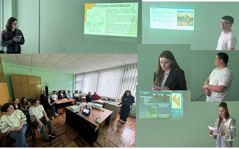
On May 21, a student scientific and practical conference titled 'Geodesy, Land Management, and Geo-informatics' was held, organized by the departments of land management, cadastre, land monitoring and geo-informatics, geodesy, and cartography as part of the Science Festival of NUVHP.
The conference took place in person in building 7 of NUVHP, while some participants joined the event online.
The topics of the presentations covered issues of spatial planning of territories, SLAM scanning, monitoring of land and forest areas using satellite data, geodetic monitoring of structure deformations, as well as the use of geo-information technologies for territory analysis and modeling.
The conference provided a great opportunity for students to present the results of their scientific work and gain experience in public scientific speaking. Participants had the chance to present their bachelor's theses in advance, receive recommendations and advice for improvement before their upcoming defense.
We sincerely thank all the students who participated in the conference for their engagement, interesting presentations, scientific inquiry, and commitment to professional development!